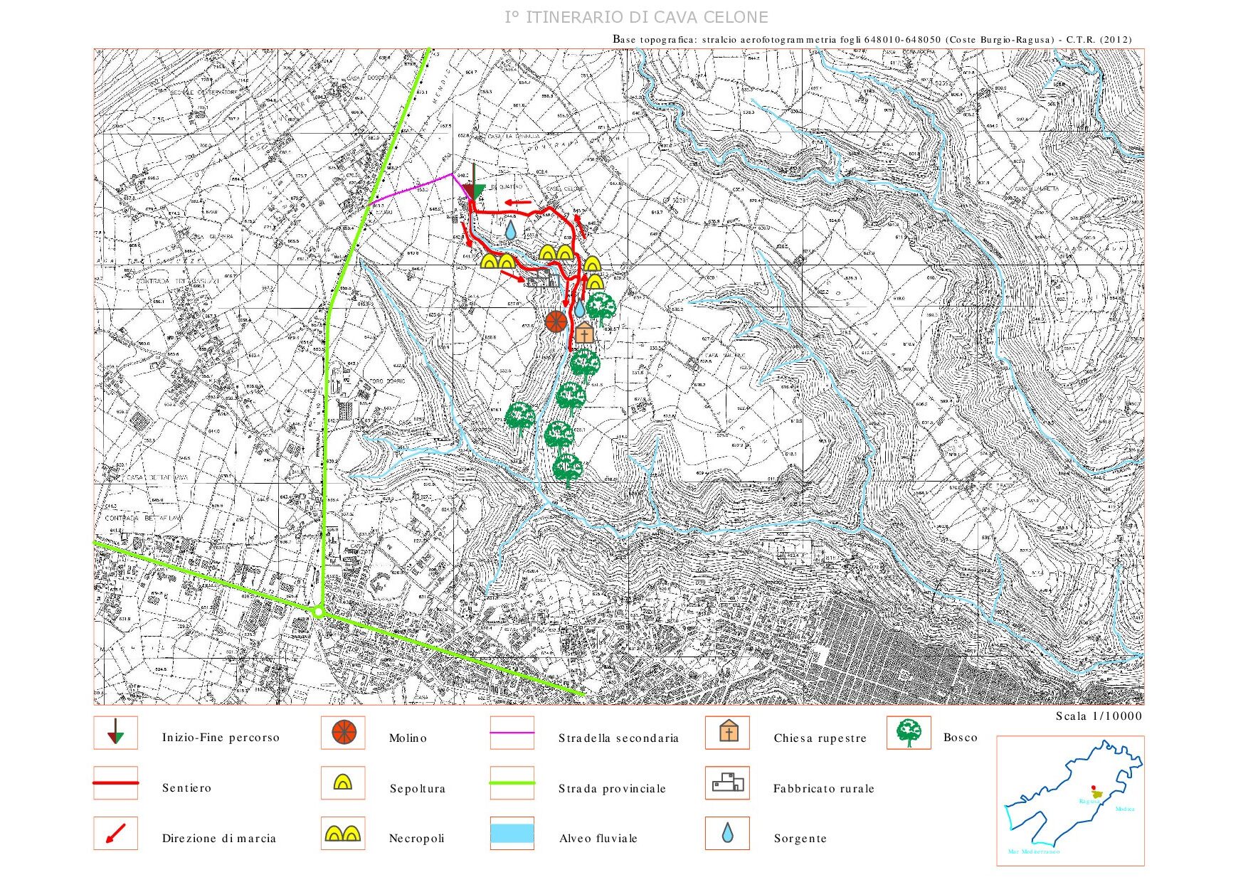
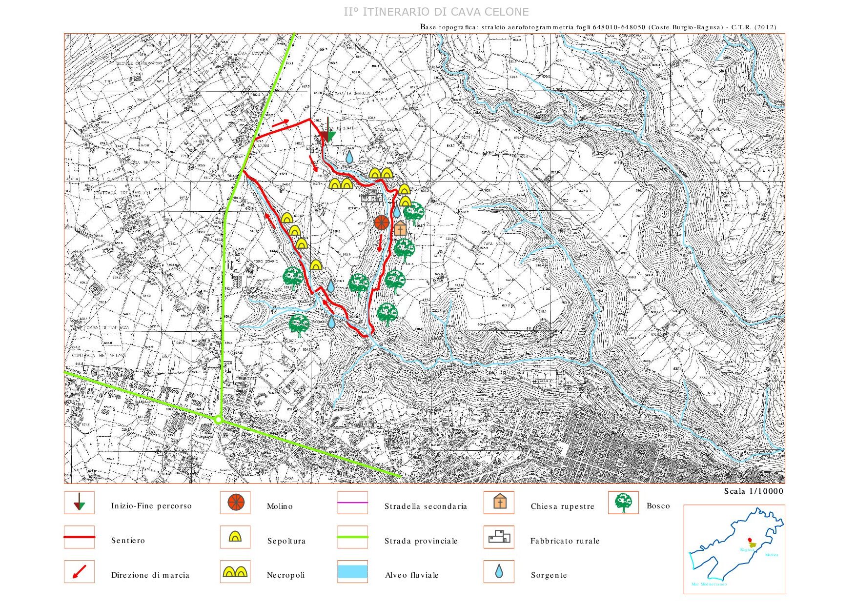
Itinerary of Cava Celone
Hiking itinerary
- Departure: Modica
- Trekking time: 6-7 h (including stops)
- Difficulty: intermediate, suitable for children and adults with trekking experiences and with a minimum of training
- Length: about 12.5 km
- Max altitude: 408 m; Minimum altitude: 130 m; Difference in altitude: 278 m
THE COURSE
The quarry is of great archaeological importance due to the presence of tombs from various eras, from the prehistoric period to the late ancient period. The hiker will be able to visit three large catacomb complexes and other smaller ones. It is possible to identify all the types of early Christian tombs from the niches, to the formae, up to the arcosoli. A very common type of tomb in the Maltese and Syracusan areas is the pseudo-canopy tomb. All these underground and non-underground structures highlight the presence of a large peasant community in this area, which lived in the area since the prehistoric period. The quarry is crossed by an ancient path partly carved into the rock that connected the city of Ragusa with the plateau. Access to the archaeological area is via a short path that leads to the so-called “Scalazza”. It is an evocative itinerary that offers the opportunity to immerse yourself in the archeology and natural and landscape beauties of the Cava, where the low Mediterranean scrub thrives, while the garrigue and bare rock dominate on the slopes. In addition to the archaeological evidence, the presence along the route of ancient water mills for the grinding of wheat, of bottini for capturing spring waters and the rock church of S. Lio, where the Greek-speaking community that lived in the area professed their own cult.
USEFUL INFORMATION AND CONTACTS
Equipment: Clothing suitable for the season: boots, jacket or windbreaker, hat, a backpack with water, trekking shoes and comfortable clothes, a flashlight and a camera.
LOGISTICS INFO OF THE ITINERARY:
- Nuccio Pisana cell.: +39 334.226 6249;
- Pietro Cavallo cell.: +39 366.132 1345
HOW TO GET:
The route develops in the territory of the Municipality of Ragusa. The starting point of the itinerary is easily accessible, starting from the roundabout in Viale delle Americhe and traveling along the SP 10 for 2.5 km from Ragusa towards Chiaramonte Gulfi. Immediately after the km 2 sign, turn right (sign) onto an asphalted road that runs for 700 m until you reach the parking lot near a farm (Casa Di Quattro), next to the tourist sign for the entrance to Cava Celone.